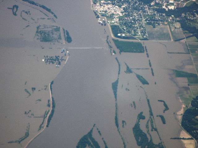
The Mississippi out of its banks in 2008, in what will seem in retrospect a minor event in comparison with the great flood coming. (Photo by Kevin Dooley/Flickr)
A surge of water greater than anything seen in nearly a hundred years is gathering in the upper Mississippi River today. It is moving slow, and will work its will on the river states during most of the month of May. If, as forecast, it crests at 53.5 feet (the height of a six-story building) above normal at Vicksburg on May 18, it will be the greatest flood seen on that river since 1927. Because it is moving slowly, its high waters will linger in some places for eight days.
The 1927 flood was one of the greatest national disasters in American history. It inundated 27,000 square miles, the rough equivalent of New England, reaching out in places to a width of 70 miles. A million people became refugees. Almost all the levees contructed by the US Army Corps of Engineers, which guaranteed a worried public that they would not fail, failed.
In 1928, Congress passed the Flood Control Act, directing the Corps of Engineers to do exactly what it had done before, only more so. They’ve been doing it ever since.
Yesterday, a Federal judge ruled that the Corps can go ahead with its plans to blow the levee at Birds Point, Missouri, in order to draw off surplus river water into a floodway that was prepared for that purpose pursuant to the 1928 legislation. [UPDATE 05/03/11: After the Supreme Court refused to review the judge’s decision, the Corps blew the levee late last night.] But that floodway is now 130,000 acres of prime Missouri farmland. Although the purpose of using the floodway is to reduce pressure on the entire, gargantuan system of levees downstream all the way to the Gulf, Missourians have seized on the idea that it would benefit Cairo, Illinois, just upstream from Bird Point. The politicians have turned it into a state vs. state, farm vs. city, local vs. Washington kind of fight, with the extra garnish that the population of Cairo is mostly black, and Missouri farmers are mostly not.
Not mentioned in the brouhaha: much of the floodway is going to flood anyway; what should people expect when they build their homes and farms in a designated, labeled floodway; and what are the effects going to be of losing 130,000 acres of planted crops on a grain market already expected to be strained to its limits by this fall? (See World, US Food Supplies Faltering, Prices Rising)
According to the National Weather Service (as reported and explained by Dr. Jeff Masters of the Weather Underground) this flood is expected to reach heights not recorded in the 100 years or more that records have been kept, at five of the ten main flood gauges on the 400 mile stretch between Cairo and Natchez, Mississippi. The first record to fall will probably be Cairo’s, where the flood is expected to crest tomorrow, May 1, at 60.5 feet — a full foot higher than the 1937 mark.
There is little doubt that we are about to see a great national catastrophe which, especially when added to the tornado damage already done across the South, will present an historic challenge to a beleaguered country. What remains to be seen, and what depends on the fate of the Old River Control Structures (See Mississippi Rising: Apocalypse Now?), is whether it goes well beyond catastrophe.
[For updates on this and other stories, check out the Editor’s Log.]
Wow! I wonder why others don’t go beyond the top of page 1 of their google search in order to find this type of accurate information. It deals with the whole system, as opposed to the point specific situation currently named by the MSM, plus you refered to Jeff Masters, he is amazing. Thanks fot this.
Thank you, Silvie. Hope you’ll subscribe and stay with us. It’s going to be quite a ride.
hold on Mississippi River Valley…looks like it’s gonna be a rough ride…what about moving people?…there were plenty of buses in NOLA during Katrina…in the water
Same problems going north along the Red River but no diversion zones.